Beinn a' Choin was a mountain I’d been looking forward to climbing for weeks. Beinn a' Choin is one of my local mountains, situated just a few miles drive from my home in a remote area of the national park rarely explored by tourists. However… I had also been putting it off, for just about as long as I had been excited about it. Despite Sarah allocating me the days in previous weeks to ‘bag it’ I had always found a convenient excuse not to go! The prospect of hiking without Eve was filling me dread!
Beinn a' Choin was going to be the first mountain (or any hike for that matter) without Eve! It wasn’t that I felt a need to have my 10 year old daughter with me, rather the adjustment to something different was overwhelming! Having hiked as much as we have together, I’ve become so accustomed to focusing on Eve, her wellbeing and happiness. When the weather closes in, my focus is on Eve! Going out on my own would remove all of that, and I would have nothing else to concern myself with, except me!
So, in the nicest possible way Sarah, (with some authority), told me to go, so I did, and it was an epic day!
Beinn a' Choin is a Corbett. A Corbett is any mountain between 2500 and 3000 feet. There’s a bit more to it than that, but that’s the basics of it. Munro’s, Scottish mountains over 3000 feet, get all the attention and all the foot traffic, leaving the corbetts largely untouched, except for a few famous ones such as Ben Venue and Ben Ledi!
Corbett bagging is going to be one my personal challenges, leaving their bigger brothers, the Munro’s, for both Eve and I to do together!
Beinn a' Choin starts from the RSPB car park at Inversnaid. I arrived there in the rain at just after 9 am. The sky above me was swirling with clouds and rain was coming down over Loch Lomond. I had expected it to be cloudy but it looked ominous.
It was the oddest feeling getting out of the car on my own, locking up and heading off with my backpack on. I had to fight the urge to ‘search’ for Eve! When we hike I normally have her infront of me. Not just out of choice, she is normally faster than me, but it’s also reassuring to be able to see her!

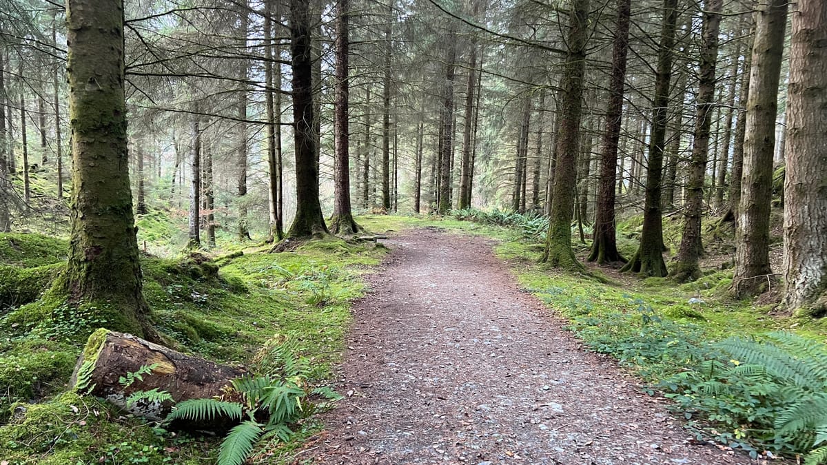
The route started by taking me along a thin muddy track that looked like it was only ever used by quad bikes. There was no signs of any other traffic, including footprints, despite making a concerted effort to find some! There was plenty of hoof prints from deer however!

This time of year is rutting season for the red deer. This can be a dangerous and lethal time, to the point that many hillwalkers won’t venture out into highland territory out of fear! As I walked I was very aware that red deer were in the area. Any night time trip to Loch Lomond at this time of year will leave you feeling like you have stepped into Jurassic Park. The ‘roar’ of the red deer can be terrifying in the darkness of the night! I was listening intently for the roar that never came!
Walking along the track was easy but it wouldn’t last for long!
There’s very limited information online about Beinn a' Choin and what there is, is old and out dated. But one thing that was obvious, Beinn a' Choin had no trail to follow unlike most of the larger Munro’s. Today would be a hike that would require a lot of effort and navigation!
Walking along the trail I had set myself a target; I was looking for any trail heading off on my right into the mountains. Reaching a burn I knew it would mean I had gone too far! I reached the burn with a substantial bridge, without even a hint of trail heading into the mountains. Today was going to be a tough day!

I backtracked slightly looking for anything at all that might indicate a trail, but again I saw nothing. The only thing that caught my eye was a gap in the trees a few metres off trail! This, as it turned out was the start of the climb! This was also one of the few times I used the GPS on my phone.

Heading into genuine, remote and barren mountain landscapes, I find a map and compass more useful than a GPS. A phone screen is small and limits what you can see as well as being unreliable. Today was no exception. On the occasions that I did try to check the GPS it couldn’t get a fix on my location. With the thick covering of clouds in the sky, it was no surprise the satellites were struggling to get their signal through.
With the compass around my neck, I took regular bearings and headed off to reach a landmark to then repeat it again and again!
The terrain was really tough going. Thick, long tussocks of grass with deep holes filled with water. It was so hard going that I was becoming more and more relieved that Eve wasn’t with me! For all of her grit and determination, her legs are simply too small and she would have become stuck! I pushed on breathing heavily and wondered if I should have picked such a challenging wee hill given the fact that the nights are now longer than the days!
I pushed on, concentrating on my route, staying upright and not falling over, and without meaning to, talking to myself out loud about all manner of subjects!

That’s one of the things I love about hiking and being in the mountains so much! It simplifies life and leaves nothing but you, your thoughts and the terrain! It’s amazing how many issues and problems in life I can solve whilst walking! It’s exhausting for the body but revitalising for the brain! The perfect combination, and I love the feeling!
After a lot of hard, slow walking, I reached a deer fence. It was a relief to reach it. I had seen it on the map as a boundary and could see it in the distance but reaching it was alluding me! For every step forward it felt like I was sinking up to my knees. I took the opportunity for my first break!

The weather today, despite looking ominous with a few minor rain showers sweeping in and out, was surprisingly warm! I did have my waterproof jacket on at times, but it was mostly to keep the wind off me. When I did have it on I just sweated, so most of the time, I just let myself get damp or windswept! It was the lesser of two evils.
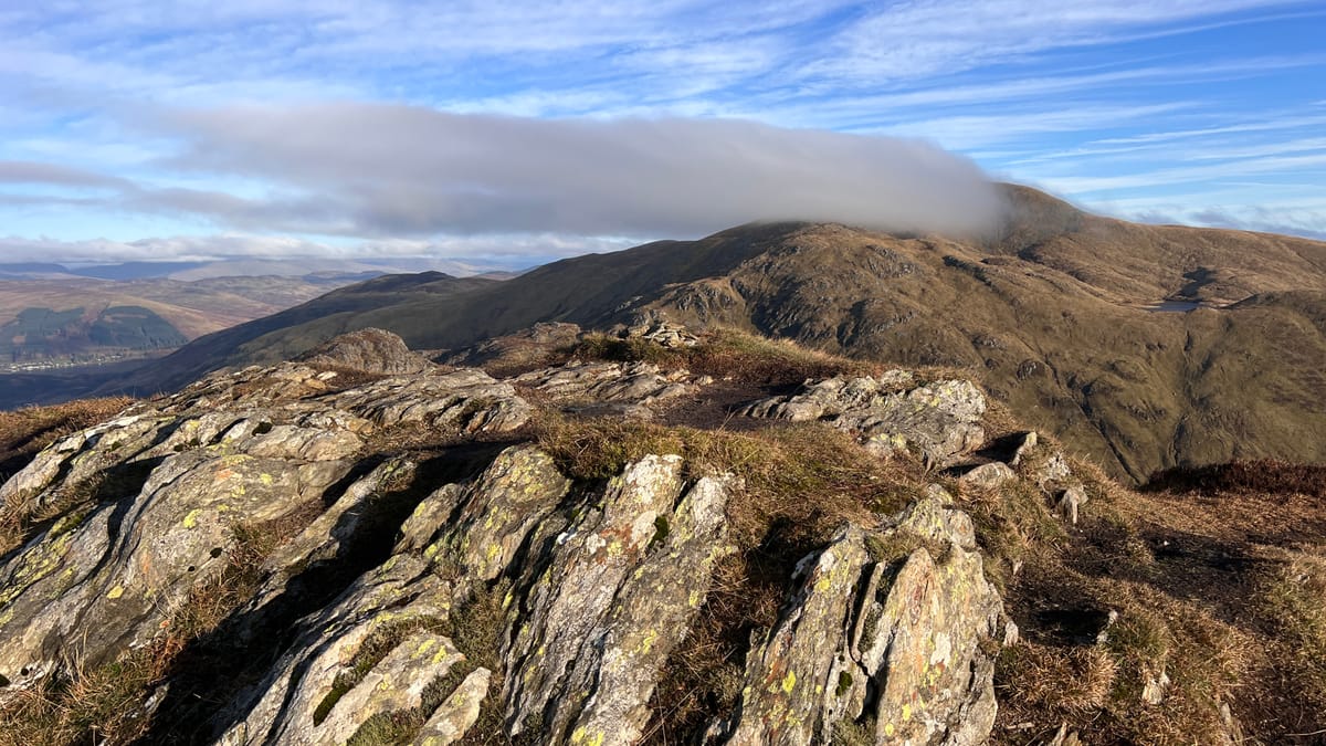
By now, the views behind me were opening up, giving me some breathtaking scene! Looking over Loch Lomond towards the Arrochar Alps was outstanding, and it only got better as the day went on!

On a clear, sunny day you could easily see for miles, but on a moody day, it added an atmosphere, that was everything I could have hoped for! Today was perfect! A challenging trail, a mountain all to myself and weather that added an atmospheric feeling that connected with me like nothing else can!
Using the map and compass I started to head over tough ground again towards the rocky and craggy knolls that would be the start of the mountain summit, albeit still a mile or two further on.

This terrain I find is the hardest of all to navigate and walk through. In open land you can just keep walking, following a compass bearing with little to stop you or get in your way, except for a bog, burn or maybe a river. But trying to find a route through steep, rocky crags, intersected with burns is hard! It does keep the mind busy however and I was constantly reassessing my route decision and looked for better options. The difficulty was routes can usually be seen better from a short distance away, but up close it can be hard to distinguish between your original route choice and another! This is where good compass work and pacing can be useful and that’s something a GPS on a iPhone can’t easily replicate!
Being it was here where I got my first good views behind me and up to Stob An Fhainne. Stob An Fhainne would be the second hill of the day, albeit not a Corbett. I planned to go over Stob An Fhainne on my return route after summiting Beinn a' Choin. It looked like an impressive hill from this angle with an easy approach! I was looking forward to it!

Winding through the crags that towered overhead was as fun as they were imposing. It felt good, although I know Beinn a' Choin isn’t known for being particularly rocky!
The wind however was becoming increasingly powerful and made the hiking tougher still!
Just before the true summit, there is a false summit, a few small but beautiful lochans and a large area of open peat and bog! I had no idea if that’s deep or can be walked over, but I wasn’t taking the chance, so I walked around it, only to realise I had gone to the wrong side, putting me of the east side of the summit, when I needed to be on the opposite side!
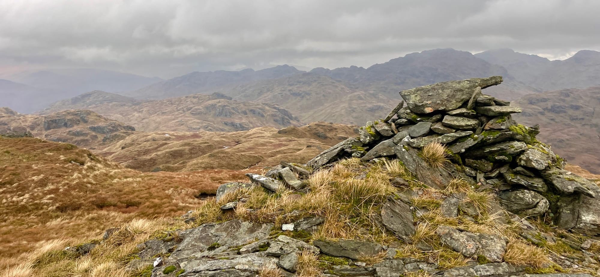
What this did do is afford me some stunning views towards Loch Katrine and the mountains to the north! It was spectacular, as all the views from this elevation are! This was my favorite sections of the whole hike!

Seeing the summit of Beinn a' Choin come into view was fantastic and felt incredible! It was also emotional as I normally share these moments with Eve and give her a huge “congratulations” but there was nobody to bestow my excitement onto!

But it was short lived. I reached the rocky summit in a wind that was so powerful I struggled to not be blown backwards! The summit, being rocky, also didn’t offer a simple route up to the small cairn.
I walked around to the left to try and find a simpler, safer route. A few moments later I was on the summit.

The summit is capped with a small cairn surrounded with the most awe inspiring views you could ever wish for! If it wasn’t for the wind, I could have sat there all day, lost in my thoughts and imagination!
But that wasn’t going to happen. The wind was too strong and my stomach was rumbling. It had gone midday by now, I was hungry and I wanted to phone Sarah to tell her I had reached the top! I was amazed to see I had full phone signal when I was taking photographs and a short video!
I retraced my steps, still managing to end up on the wrong side of the crags, having then to push past a huge area of bog and the wee lochans again, which were beautiful approaching from both angles!

I descended further, going steeply downhill through long, thick grass that hid deep holes that made the risk of a twisted ankle a very real risk. I used my hiking poles with every step, but the steepest section of the day was still to come.
Once back on the lower area between Beinn a' Choin and the start of Stob An Fhainne I found a rock to sit on for my lunch.

The wind around this area was considerably less aggressive than on the summit, but there was still a cold wind that, despite the warm air temperature, cooled me within a few minutes. I decided not to ‘sit out’ or put my puffy jacket on, rather just plod on with flask in hand as I sipped hot coffee! It felt good and I still hadn’t seen any signs of human life anywhere. Except for an old fence, i didn’t even any find any rubbish on the floor which is almost guaranteed on a Munro!

The hike up Stob An Fhainne was, in comparison to Beinn a' Choin, the most simple and easy of all the hillwalking of the day, despite looking formidable from the elevation of Beinn a' Choin. I even surprised myself just how quickly I got to the unremarkable summit!
The summit of Stob An Fhainne is marked with a large and abandoned fence post that has been drilled into the boulder. The views over Loch Arklet and Loch Lomond were amazing!

I felt it was particularly impressive to see Loch Lomond from this angle, having hiked along its banks on so many occasions!

From the summit of Stob An Fhainne, the descent got a bit tricky. The generally accepted route, from the very few people who have hiked to this summit, is to go immediately past the summit, heading south for a few hundred metres or so, before heading right (west)! This proved to be challenging at best and dangerous at worst.
This led me straight into an area of crags, that despite not being particularly high, falling off would be problematic!!! There was no obvious route through or around without going down some steep gullies that, again were not high but treacherous all the same, and that’s on a good day!

I decided, looking at the map and the terrain, to backtrack, go over the summit again and push to the left (west) to start my descent by creating my own huge zig zag route by following the natural contours.

The route was still steep but provided an easy to follow path that led virtually ‘as the crow flies’ towards the RSPB carpark at Inversnaid. Infact, I could see the car as a speck in the distance!

Although this was the steepest section of the whole day, I would also say it was the most fun! Not for the steepness, but having to find my own route on challenging terrain with little chance of getting actually lost or going wrong! Sometimes it’s the little things in life that are the best!
Roughly halfway down I came up against a deer fence. The deer fence disappeared into distance one way and over a rocky crag the other. I had positioned myself where I knew there was a way through the fence only to find no evidence of any way through it. I walked a short section of it trying to find a gate or ladder, but found nothing!

The only option, to avoid a trek, was to climb over it! So I found a suitable place next to a large post to make my attempt. I made sure my bag and poles could be pulled over, without throwing or dropping them. I didn’t want to risk breaking or damaging anything unnecessarily.
I managed to get over the deer fence with little issue or complication, which was a relief. I wasn’t worried about hurting myself, but my trousers have been sewn and repaired so many times I couldn’t be bothered with the prospect of yet more sewing! I'm also very attached to them as we have been through a lot with me over the years!

By now the time was mid afternoon and I was feeling very fatigued. It wasn’t much further to reach the car but I had another small obstacle to navigate.
I had to push through a vast area of ferns that had died and wilted over the last few weeks. But they had not quite dried up and become brittle. They were still flexible and pliable.

As I tried pushing through, the ferns would wrap around my legs and ankles causing me to stumble. If it wasn’t for my hiking poles I would have ended up on my face on multiple occasions. What little energy I had left was sapped by the ferns.

A short while later, I stepped over a burn and into the RSPB car park. I was pleased to see the car but also sad the day was over! It had been a great day, although physically demanding and emotionally challenging, especially with Eve not being there.
In hindsight, being back at the car park, and not having Eve with me on this mountain was a good thing! I think she would have struggled. I struggled in places! I recorded a quick video, phoned Sarah to tell her I would be home soon and drove home!
The hike up Beinn a' Choin was one of the biggest milestones I had for myself since we completed Scotland’s Great Trails. Overcoming the emotional aspect of not having Eve with me and the mental challenge of not having to focus on Eve, her safety and her well being was always going to be tough!
I can’t wait for the next one, and the feeling of total solitude! It’s medicine for the soul!
Well guys, that’s it for this journal! Thanks for reading and I hope you enjoyed this window into my world outdoors.
Ian
Buy Me a Coffee
Thanks for reading! I hope you enjoyed my Beinn a' Choin journal. If you did, please consider buying me a coffee or just share this with a friend. Your support is genuinely appreciated. Thank you. Ian
Buy Me a Coffee ☕️


Comments